
Paris, the “City of Lights”, is undeniably drenched in history. Every corner, every cobblestone, and indeed every street name whispers tales of yesteryears. But how often do we stop to wonder about the stories behind these names? Ever pondered on why a particular street in Paris is named “Rue des Mauvais Garçons” or the “Rue Pierre et Marie Curie”? If curiosity beckons, there’s a brilliant tool awaiting you.
Discovering Paris Street by Street
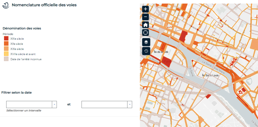
A recently launched interactive map titled ‘Nomenclature officielle des voies’ serves as a historical guide, shedding light on the naming chronology of Parisian streets. A brainchild of the Département de la Topographie et de la Documentation Foncière (DU) and the Bureau de la Géomatique(DSIN) of Paris, this application is a delightful dive into Paris’s past.
From the ancient Forum Lutécien to the ambitious renovations of Baron Haussmann, and via the quaint cobblestone alleyways reminiscent of medieval Paris, each street tells its own unique tale. Now, thanks to this incredible interactive tool generously offered by the city, history enthusiasts and curious wanderers can lose themselves in the stories that paved the way for the modern-day Paris.
Rediscovering Paris – A Digital Guide to its Streets
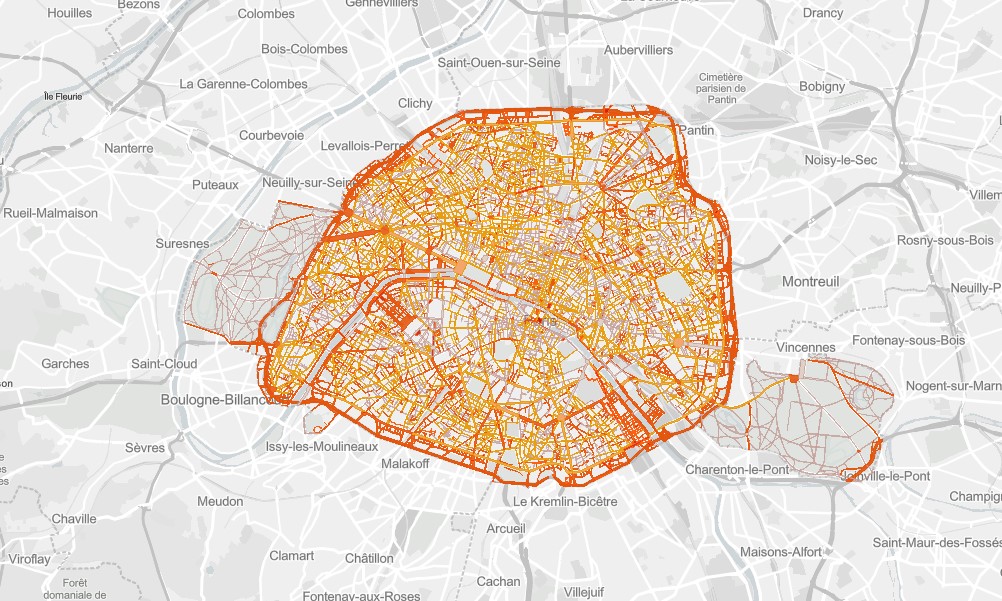
Interactive maps of Paris have revolutionized the way tourists and locals explore the city. Whether hunting for a sunlit terrace in real-time, tracing the history of streets, or spotting exquisite street art, these maps provide a unique and innovative way to rediscover the French capital. The ‘Nomenclature officielle des voies’ map stands out, offering insights into the heart and soul of every path that crisscrosses the city.
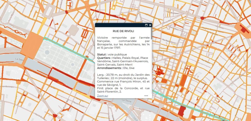
Engaging with the map is a breeze. As you navigate through the streets of Paris, simply hover over the one that piques your interest. A treasure trove of information awaits— details about its status, naming history, and intriguing tidbits. While this digital rendition feels so 21st century, it’s noteworthy that its origins trace back to 1873! The city has diligently maintained, updated, and enhanced this historical document ever since.
For those eager to embark on this historical odyssey, the map is readily accessible – https://capgeo.sig.paris.fr/Apps/NomenclatureVoies/.
So, the next time you amble through Paris, remember that beneath your feet lie stories waiting to be uncovered. Dive into the tales that have shaped this enchanting city, one street at a time.